|
|
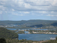
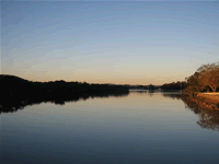
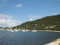
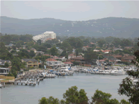
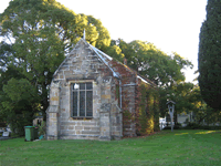
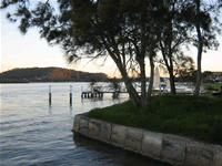
Brisbane Water is a mostly shallow tidal bay located at the southern end of the Central Coast of New South Wales, approximately 90km from Sydney. The city of Gosford is found at its most northern extent and its shores are lined by Woy Woy, Davistown, Kincumber, Bensville, Saratoga, Point Claire and Hardys Bay. Ettalong, Patonga, Pretty Beach, Umina and Umina Beach are situated at the mouth of Brisbane Water where it joins onto Broken Bay which in turn forms the mouth of the Hawkesbury River. It contains several islands including St Huberts Island and is rich in aquatic life, including sea weeds, mangroves, oysters, sharks, rays and a good population of various species of fish. Brisbane Water was named after Sir Thomas Brisbane, governer of New South Wales between 1821 and 1825. The Brisbane Water of YesterdayAfter the arrival of the first fleet in 1788 at Sydney Cove it became apparent that for the colony to survive and prosper good farming land would have to be found. Scarcely a month after the fleets arrival Governer Arthur Philip led a small group of officers and marines on an exploratory journey along the coast north of Sydney Harbor. He found very little of immediate use to the colony due to the mountainous terrain and it wasnt until a year later that a more thorough exploration of the area took place and the Hawkesbury River was discovered, providing land more suitable for agriculture. Brisbane Water however remain of little interest to the Europeans. James Webb is credited with being the first white settler of the area. Originally a soldier in the New South Wales Corps, he recieved permission to temporarily occupy 300 acres of land on the eastern side of Broken Bay for the purpose of running cattle. In September 1824 he requested and received a grant of 100 acres on the western side of The Rip, a tidal current that is concentrated in the channel where The Rip Bridge is today. The area was named Mullbong Farm. Timber-getters began operating in the area in 1820 obtaining forest oak and ironbark for building purposes. Red cedar was also in demand for manufacturing furniture however stocks of this timber were heavily depleted within a decade. Other early industries in the area included ship building, which persisted to the mid 1950's, and shell mining of natural shellbanks and aboriginal middens for the manufacture of lime, which was used in mortar for building purposes. With the railway from Sydney to Newcastle completed in 1889 a steady stream of middle class tourist began to visit the area in increasing numbers. Woy Woy, Empire Bay, Davistown and Saratoga in particular became holiday destinations for those eager to escape the hustle and bustle of the cities and by 1911 there were at least 20 boarding houses on the Woy Woy Peninsula alone. The Brisbane Water of TodayThe Brisbane Water of today is a fantastic blend of residential haven and tourist paradise. The Woy Woy Peninsula has long held a reputation as the ideal weekend getaway with many accommodation options available for those wishing to escape the hustle and bustle of city life and all such an easy drive from Sydney. With two national parks within easy travelling distance of the peninsula and a variety of beautiful pristine beaches to enjoy there is no wonder Brisbane Waters popularity shows no sign of abating despite having paid host to visitors for well over a century. Opportunities for fishing, surfing, boating, water skiing, swimming, shopping and bushwalking abound and the area is well provided for in the way of picnic and barbecue facilities as their are numerous reserves and parks to enjoy. Woy Woy also has an enjoyable nightlife thanks to the clubs located nearby.
© 2008 Centralcoast.info |