|
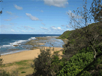
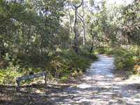
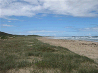
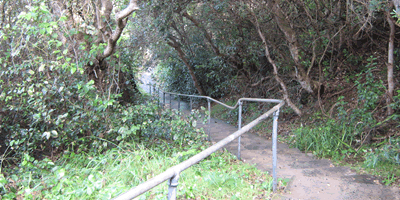
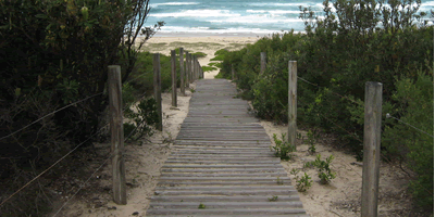
Wyrrabalong was gazetted in May 1991 and is divided into two parts which when combined equal about 597 hectares. North Wyrrabalong covers most of the North Entrance Peninsula between The Entrance North and Norah Head and is approximately 480 hectares. South Wyrrabalong comprises of about 120 hectares in Bateau Bay from Shelly Beach South to Forresters Beach. Terilbah and Pelican Islands on Tuggerah Lake are also part of the park. Wyrrabalong National Park has wide range of landform features. The North Entrance section of the park comprises mainly of sand dunes which are as high as 50 metres close to the lake. Small swamps and wetlands are interspersed between the dunes. Part of the park was mined for sand in the 1960's and 1970's however the western part of the peninsula retains its natural formation. This section of the park contains the only littoral rainforest of a size that warranted protection on the Cental Coast and a number of rainforest species reach their southern limit of distribution here. South Wyrrabalong mainly consists of cliffs and extensive rock platforms however there is a mangrove colony on the southern end of Bateau Bay Beach and is significant because it is uncommon for mangroves to occur in such a location. Terilbah Island is a natural sand island which formed in the 19th century however Pelican Island was formed by the dumping of dredging spoil during works to deepen the Entrance Channel during the 1920's. Aboriginal camps, burial and midden sites have been found within the park. The midden at Pelican Point is of great archeological significance as it is one of the few relatively intact middens on the Central Coast. A number of rare and endangered birds have been recorded in the park and it provides food and nursery sites for many mammals including the Squirrel Glider and the New Holland mouse. Commonly enjoyed activities throughout the park include walking, fishing and swimming however the park has no camping within its boundaries. Nearby The Entrance North, Bateau Bay and Long Jetty have several options for accomodation. Places of InterestWilfred Barrett Drive car park in North Wyrrabalong is the starting point of Burrawang Track and the Redgum Trail. Burrawang track joins onto the beautiful Lillypilly loop trail and is of reasonable difficulty due to the undulating sand dunes. The Redgum Trail also joins the Lillypilly loop trail by a more circuitous route and also joins the Wetlands Trail which can also be accessed from Canton Beach in Toukley The Coastal Walking Track is of reasonable difficulty and stretches 3.5km from Shelly Beach to Wyrrabalong Lookout via Crackneck Lookout. Both Wyrrabalong and Crackneck Lookouts have picnic facilities. The entire Coastal Walking track offers spectacular views and is often frequented by whale watchers during the winter months. Pelican Beach is accessed by a sealed road almost directly opposite the Wilfred Barrett Drive car park that is open during daylight hours only. It is a beautiful secluded beach ideal for fishing, surfing or simply strolling along.
© 2008 Centralcoast.info |
|